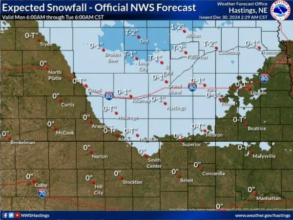
Projected snowfall totals for Monday, Dec. 30, (NWS Hastings, Courtesy)
HASTINGS — Rain is moving into the area this morning and will eventually change over to snow later this afternoon. Most of central Nebraska will see generally 0.5 inches or less.
Light rain has been spreading through the western parts of the National Weather Service – Hastings’ coverage area. By midday the most persistent rainfall will be over the northern and eastern parts of the area.
The transition over to snow will start in the 2-4 p.m. timeframe, but relative warm surface and low level temperatures will likely prevent any accumulation until at least after sunset.
Between 5 p.m. and 8 p.m., some areas will continue to see rain transition to snow, generally from north to south as surface temperatures finally start to fall.
The heaviest snow accumulation could occur north of Highway 92 with up to one to two inches. The rest of the area will likely see 0.50 inches or less of total precipitation.
In addition to the precipitation, northwest winds are set to increase this afternoon into the evening. The strongest winds, 45-55 mph, look to be a line west from Kearney down into Osborne, Kan.
The entire area will see gusts around 30-40 mph through the evening into tonight. The snow falling at the time will be rather wet, so blowing and drifting snow does not look to be a concern. However, the wind gusts could cause reduced visibility during the periods of heavier snowfall.
The snow should come to an end between midnight and 3 a.m. as the quick moving low-pressure system responsible for the precipitation continues its track to the east.
Looking ahead, there looks to be the potential for another winter system on Saturday into Sunday, with a more significant push of cold air behind it. Subzero temperatures look likely at some point in the coming week.


