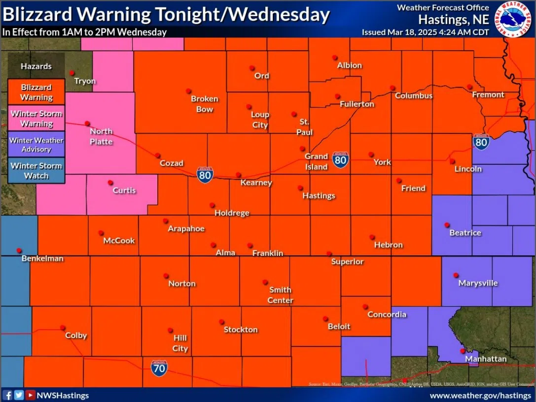
Blizzard Warning in effect for central Nebraska on Wednesday, March 19, (NWS Hastings, Courtesy)
HASTINGS — The Winter Storm Watch that had been issued across central Nebraska has now been upgraded to a Blizzard Warning for the early morning through early afternoon of Wednesday, March 19.
Rain with isolated thunderstorms will be possible Tuesday evening before changing over to snow. These amounts could reach two to five inches across the area, some isolated locations could see six inches, according to the National Weather Service – Hastings.
Strong winds around 50-60 mph with blowing snow will result in blizzard conditions and hazardous travel across the region. The Blizzard Warning is in effect from 1 a.m. Wednesday until 2 p.m.
Visibility may drop below a quarter of a mile due to blow snow, expect travel impacts to the Wednesday morning commute.
“Travel should be restricted to emergencies only. If you must travel, have a winter survival kit with you. If you get stranded, stay with your vehicle. The latest road conditions for the state you are calling from can be obtained by calling 511,” per NWS Hastings.
Persons should consider delaying all travel. Motorists should use extreme caution if travel is absolutely necessary.
“A Blizzard Warning means severe winter weather conditions are expected or occurring. Falling and blowing snow with strong winds are likely. This will lead to whiteout conditions, making travel extremely dangerous. Do not travel. If you must travel, have a winter survival kit with you. If you get stranded, stay in your vehicle,” per NWS Hastings.