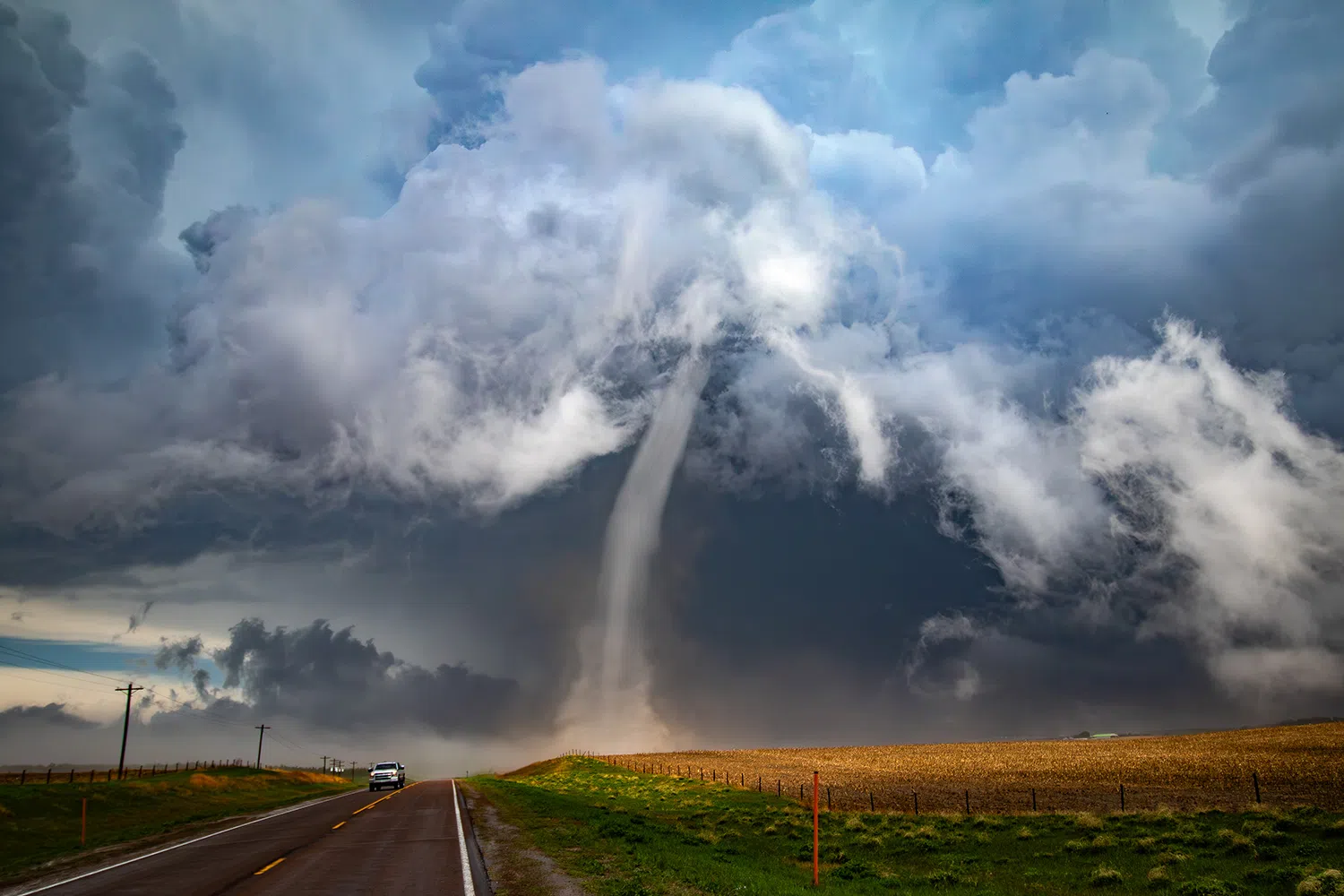
An EF-1 tornado near the end of its life north of Ravenna on April 26, it was the first to occur as part of a tornado outbreak in Nebraska, (Brian Neben, Central Nebraska Today)
HASTINGS — Of all the hazards spawned by severe weather, tornadoes are likely the ones that capture the greatest share of the public’s imagination. Knowing when to take shelter and what type of shelter to take is key to tornado safety.
At the most basic level, a tornado is a violently rotating column of air that is connected to both the ground and a cumulonimbus cloud.
They come in a number of shapes and sizes and are often, but not always, visible in the form of a condensation funnel with a cloud of rotating debris and dust beneath it.
A tornado can be in progress without a fully condensed funnel.
Most tornadoes feature wind speeds around 110 miles per hour and are only on the ground for a few miles but in the most extreme cases, winds have been measured around 300 mph and can stay on the ground for more than 60 miles.
There are also differences in how tornadoes are formed, the most common are those connected to a supercell, a thunderstorm that features a rotating updraft. There are also landspouts and waterspouts that are not connected with a supercell.
“Tornado formation is believed to be dictated mainly by things which happen on the storm scale, in and around the mesocyclone. Recent theories and results from the VORTEX2 program suggest that once a mesocyclone is underway, tornado development is related to the temperature differences across the edge of downdraft air wrapping around the mesocyclone,” according to the National Severe Storms Laboratory, (NSSL).
Tornadoes occur most frequently in North America, particularly in central and southeastern regions of the United States colloquially known as Tornado Alley.
Tornado season usually refers to the time of year the U.S. sees the most tornadoes, the peak tornado season across the Great Plains is from late April to early June. Nebraska tends to see the most tornadoes during May and June.
However, “tornadoes can happen at any time of year. Tornadoes can also happen at any time of day or night, but most tornadoes occur between 4–9 p.m.,” per the NSSL.
In 2023, there were 101 tornadoes reported in Nebraska, there were 47 reported in May alone.
Tornadoes can be detected before or as they occur through the use of pulse-Doppler radar by recognizing patterns in velocity and reflectivity data, such as hook echoes or debris balls, as well as through the efforts of storm spotters.
Tornado strength is rated by the Enhanced Fujita (EF) scale, which is based on the severity of the damage they cause. The scale includes:
- EF-U: Unknown due to no damage markers
- EF-0: 65-85 mph, light damage
- EF-1: 86-110 mph, moderate damage
- EF-2: 111-135 mph, considerable damage
- EF-3: 136-165, severe damage
- EF-4: 166-200 mph, devastating damage
- EF-5: Over 200 mph, incredible damage
There are tornado watches and tornado warnings that are issued to the public, what is the difference between the two?
A tornado watch is issued by the Storm Prediction Center in Norman, Okla., and is issued hours ahead of a threat developing. They are typically large areas, covering numerous counties, even large swaths of states.
A watch indicates that the conditions are in place that could lead to a tornado being produced in the area. When these are issued, it is important to know what your safety plan is, know where to take shelter and check the forecast for updates.
Tornado warnings are issued by the local National Weather Service forecast offices. This means a tornado has been reported by spotters or indicated by radar and that there is a serious threat to life and property to those in the path of the tornado.
A warning indicates that those in the path and downstream should act immediately and find shelter.
Before severe weather or tornadoes ever strike, households should have a family plan of where to shelter. This should be a secure room underground or a windowless interior room. If an underground shelter cannot be reached, find the most interior of a building.
If caught outside, find a sturdy interior shelter right away, avoid sheds, mobile homes as they are not safe. If no shelter is nearby, seek covering in a ditch or low-lying area.
If in a vehicle in the path of a tornado, vehicles are not safe. If possible, drive to the nearest shelter. If not either stay in your vehicle and over your head or seek refuge in a low-lying area.
If your area is impacted by a tornado, stay informed for the latest weather updates, contact loved ones, assess the damage but do not enter damaged buildings.
Storm spotters look for several features of a supercell thunderstorm to indicate if it may produce or tornado. The following is from the NSSL:
Inflow bands are ragged bands of low cumulus clouds extending from the main storm tower usually to the southeast or south. The presence of inflow bands suggests that the storm is gathering low-level air from several miles away. If the inflow bands have a spiraling nature to them, it suggests the presence of rotation.
The beaver’s tail is a smooth, flat cloud band extending from the eastern edge of the rain-free base to the east or northeast. It usually skirts around the southern edge of the precipitation area. It also suggests the presence of rotation.
A wall cloud is an isolated cloud lowering attached to the rain-free base of the thunderstorm. The wall cloud is usually to the rear of the visible precipitation area.
A wall cloud that may produce a tornado can exist for 10–20 minutes before a tornado appears, but not always. A wall cloud may also persistently rotate (often visibly), have strong surface winds flowing into it, and may have rapid vertical motion indicated by small cloud elements quickly rising into the rain-free base.
As the storm intensifies, the updraft draws in low-level air from several miles around. Some low-level air is pulled into the updraft from the rain area. This rain-cooled air is very humid; the moisture in the rain-cooled air quickly condenses below the rain-free base to form the wall cloud.
The rear flank downdraft (RFD) is a downward rush of air on the back side of the storm that descends along with the tornado. The RFD looks like a “clear slot” or “bright slot” just to the rear (southwest) of the wall cloud. It can also look like curtains of rain wrapping around the cloud base circulation. The RFD causes gusty surface winds that occasionally have embedded downbursts. The rear flank downdraft is the motion in the storm that causes the hook echo feature on radar.
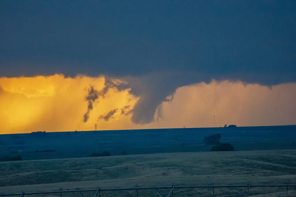
A brief EF-U tornado occurs in rural Hayes County during the evening of May 23, (Brian Neben, Courtesy)