HASTINGS — The 2024 tornado season across Nebraska saw a historically high number of tornadoes with notably active days coming early and late in the season.
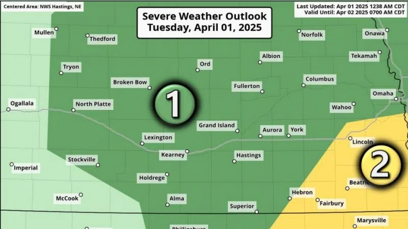
Much of central Nebraska falls under the watch of the National Weather Service – Hastings. They monitor a total of 24 Nebraska counties and six north central Kansas counties.
Statistically, May and June are the most active periods for severe weather and tornadoes for Nebraska. Spring is the estuary in which the strong winds aloft from winter mix with the moisture of the summer, both of which are important ingredients for tornado producing storms.
NWS Hastings Warning Coordinator Mike Mortiz said that there were 101 tornadoes reported across Nebraska in 2024, the third highest since records have been kept. The other historic years include 2004 with 110 tornadoes and 1999 with 102.
The month with the highest number of twisters was May with 47 in 2024. For reference, there were a total of 60 tornadoes reported in Nebraska in 2023, with 31 that May.
A day that won’t be forgotten soon in regard to severe weather in eastern Nebraska is April 26, 2024.
There were 25 tornadoes that occurred in the NWS Omaha coverage area, some of them the strongest tornadoes in the region in nearly a decade.
These included the Lincoln-Waverly EF-3 that was heavily documented as it crossed I-80 on live television, the Elkhorn-Bennington-Blair EF-4 that was the strongest of the day, the Eppley Airfield EF-3 and the Minden, Iowa EF-3 that tragically killed one person.
While eastern Nebraska and western Iowa was the focus of the tornado outbreak, the first tornadoes of the day occurred in central Nebraska.
A supercell thunderstorm took shape near Ravenna and the first tornado of the day occurred at 12:16 p.m., east of Ravenna in Buffalo County and tracked across the county line into Sherman County.
The tornado was documented at the end of its life by Central Nebraska Today.com staff as it dissipated crossing highway. It would end up being rated EF-1 with peak winds around 90 mph.
Within minutes of the Ravenna tornado dissipating, a second EF-1 tornado occurred and crossed through the eastern part of Rockville, damaging a residence and an outbuilding.
The most notable tornado this storm spawned was the Farwell-Elba EF-3. It would heavily damage a farmstead west of Elba, damage indicators noted the strongest winds would have been around 145 mph.
The fourth and final tornado produced by this storm was the Wolbach-Primrose EF-2. It was the widest of the event in the NWS Hastings area, at least half a mile wide.
What was notable about other tornado events throughout 2024 was how focused they were in or around the Highway 34 and Highway 6 corridor, Mortiz said.
For instance, tornadoes occurred near Holdrege on May 3 and just 20 days later, an EF-1 tornado tracked through the community after dark, causing damage to trees and limbs throughout the community.
Another date that stood out to Mortiz was July 6, 2024.
Mortiz said typically, tornado activity in central Nebraska winds down after July 4. He noted there could be isolated tornadoes in July, but its notable that five occurred on this day.
There was an EF-1 that passed through the northeastern part of Minden, another EF-1 that passed near Norman in Kearney County, and EF-0 tornadoes that occurred near Inland and Roseland in Adams County, Z Road in Clay and Fillmore counties.
As the severe weather season for the area approaches, it is important to understand how the public is forewarned of impending weather threats.
Weather watches, such as those for severe thunderstorms and tornadoes, are issued by the Storm Prediction Center in Norman, Okla.
Mortiz said the local weather offices collaborate with the SPC on the timing, location and duration of the watches. Once they are issued, the local weather offices can make changes as necessary.
When it comes to warnings, for everything from flooding to severe storms, tornadoes, etc., those are all handled by the local weather offices, said Mortiz.
Looking at the short-term forecast, Mortiz said that spring may get an early start across the High Plains, when in the past April’s have mainly been colder before warming up right before May.
He noted that despite the blizzard in the middle of the month, March has been on the whole warmer than in past years.
Moritiz said April 2 has signs of overnight thunderstorms and the potential for hail, with the next system around April 5-6 showing the signs of bringing more significant weather to the Plains.
When it comes to the public reporting severe weather, Mortiz said if it is an emergency, call 911, all other events should be reported to the local NWS office, emergency management or on a non-emergency line to law enforcement.
In the event of a tornado, finding shelter underground is the safest option, a basement or storm shelter. If shelter underground is not an option, find an interior room and put as many walls between oneself and the outside, avoiding any windows.
The NWS is always looking for weather information, especially when severe weather is ongoing. Reports of tornadoes, funnel clouds, wall clouds and storm structure, hail of any size, damaging winds and flooding are all important.
There is a plethora of weather information online and on social media these days, but Mortiz said it is important to have multiple credible weather sources in the event of severe weather.
Have multiple ways to access information in case of disaster and be safe in the event by knowing where to find shelter before severe weather strikes.
If 2024 was any indication, severe weather, including tornadoes, can strike at anytime and anyplace.