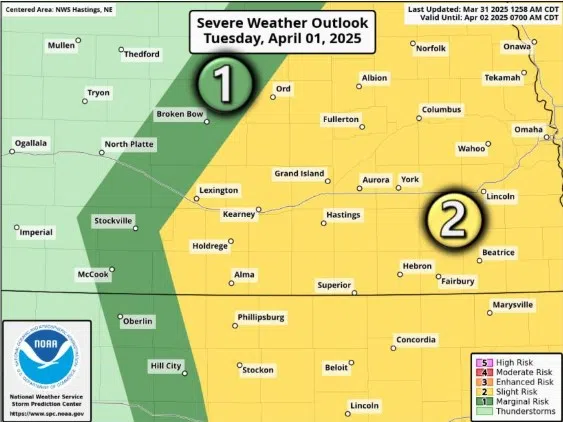
Slight Risk for severe weather issued for Tuesday, April 1, (NWS Hastings, Courtesy)
HASTINGS — Much of central Nebraska is under a Slight Risk for severe weather during the afternoon and evening hours of Tuesday, April 1.
The Storm Prediction Center in Norman, Okla., has put much of central Nebraska, from Lexington past the Nebraska-Iowa state line under a Slight Risk, a two out of five, for chances of severe weather.
According to the National Weather Service – Hastings, some of the potential storms could be strong to severe, mainly between 3 p.m. and midnight. Right now the primary threat with the strongest storms could be ping pong ball sized hail and wind gusts near 60 mph.
NWS Hastings did note there is still a fair amount of uncertainty regarding the magnitude of the potential threat and how much of the area could see storms. Some models have suggested the main threat will be entirely east of Highway 281.
The uncertainty stems from how much low-level moisture will arrive before storm initiate. If more moisture is available, the threat could be more widespread, on the other hand, less moisture will lead to a much more muted and isolated threat.
On the other hand, deep layer wind shear will be strong, so it might not take much instability to produce some severe hail and damaging wind gusts.
The severe storm threat should end by midnight as the instability departs the region.


