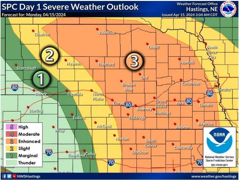
HASTINGS — An enhanced risk for severe weather exists across central Nebraska for the early evening into overnight hours with all threats possible, including tornadoes, large hail and damaging winds.
An enhanced risk, issued by the Storm Prediction Center in Norman, Okla., is a three out of five risk which reflects that numerous severe storms are possible, and a few could be intense.
A large upper-level trough of low pressure will eject into the High Plains this evening, and this will allow for scattered thunderstorms to develop and spread northeast across the National Weather Service – Hasting warning area.
Winds will increase today out of the southeast to 25-35 mph with gusts up to 45 mph.
Thunderstorms look to develop around 6 p.m. to 8 p.m. but most forecast models hold off on more widespread development until after 10 p.m.
“These thunderstorms would then race north northeast into south central Nebraska around or a bit after midnight,” NWS Hastings notes.
Threats with these storms includes large hail, possibly 2-3 inches, tornadoes will be possible with any supercells that are able to remain discrete.
As storms begin to cluster, severe and damaging winds will be possible overnight. The most likely window for more widespread severe thunderstorms will be from 10 p.m. to 3 a.m.
“All modes of severe weather will be possible including a few isolated nighttime tornadoes along with straight line wind threats. Eventually as we near dawn most of these thunderstorms will have exited our forecast area to the northeast,” NWS Hastings states.
Have multiple ways to receive severe weather warnings this evening and keep an eye out for new developments throughout the day.


