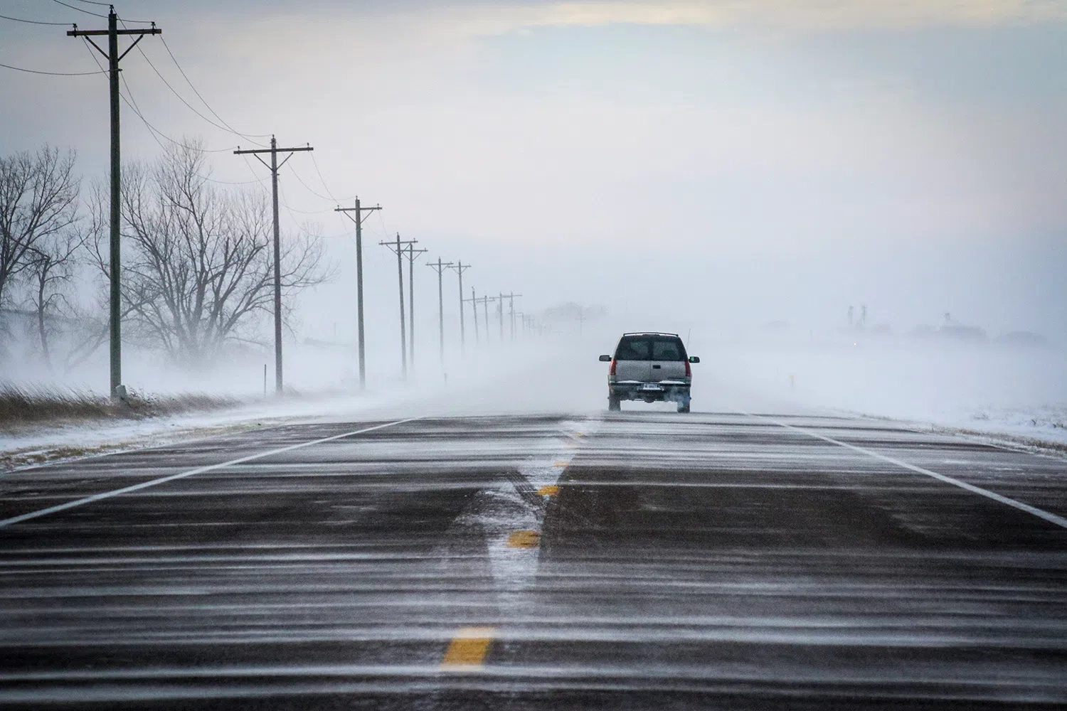
A ground blizzard in central Nebraska, (Brian Neben, Central Nebraska Today)
NEBRASKA — Like it or not, winter is fast approaching and the National Weather Service Hastings wants everyone in their coverage area to be safe and prepared for when the wind blows cold and the snow starts to fall.
This year the National Weather Service has made changes to cold weather messaging this winter.
This winter, the NWS will transition to a focus on “the cold” by simplifying a few of our winter weather products. Beginning today, Wind Chill Watch/Warning/Advisory will be consolidated into the Extreme Cold Watch/Warning and Cold Weather Advisory.
The bottom line is the NWS will focus on the impacts of extreme cold regardless of the wind. The graphic (below) provides a simple explanation of the changes for users of NWS products. This change started Oct. 1, 2024.
Specifically, the criteria for Extreme Cold Watches/Warnings and Cold Weather Advisories will be as follows:
South Central Nebraska
- Cold Weather Advisory: Air or feel-like temperatures between -20° and -30°
- Extreme Cold Watch/Warning: Air or feel-like temperatures colder than -30°
The benefit of this change is a focus on “cold is cold” regardless of the wind. Wind Chill information is not going away and will be readily available. However, the Wind Chill will not be the basis for NWS cold weather headlines. The focus will be on the cold itself.
Other benefits will be unified messaging across the United States and the ability to offer clearer Watch/Warning/Advisory maps on weather.gov and local NWS Weather Forecast Office graphics.
In addition to the changes already mentioned, the NWS is simplifying freeze related products by consolidating previously used “Hard Freeze” wording into a single Freeze Watch or Freeze Weather (see image immediately below).
These changes to cold weather messaging products (cold and freeze) are more in a series of changes in recent years to consolidate and simplify NWS products to make messaging impactful weather easier to understand. They reflect years of internal testing and external interactions with partners who desire a more simplified approach to hazardous weather messaging.
If anyone has ever wondered how winter storms are warned, the NWS uses an assessment called the Winter Storm Severity Index, WSSI. This system highlights regions and localities with the forecasted potential of damaging and life threatening conditions.
This includes, tree damage, school closures, transportation issues such as, traffic accidents, road closures and flight cancellations.
“The WSSI is comprised of six individual, but equally weighted components of winter storms,” according to NWS information, “The summary graphic is the maximum forecasted impact from any of the six impact components. The six components are:
- Blowing Snow
- Flash Freeze
- Ground Blizzard
- Ice Accumulation
- Snow Amount
- Snow Load
One task the NWS forecasters work hard to determine is the type of precipitation will occur with any given system and its timing, this requires and understanding of temperature from the ground up to 7-8 miles in the atmosphere. Temperature usually decreases with height, but at times temperature can actually increase in the lower atmosphere and this can cause issues when forecasting.
In most winter systems, ice crystals form at heights where the temperature is below freezing, as these ice crystals fall, they grow larger and form snowflakes. If the entire column of the atmosphere where the snowflakes fall is below freezing, the precipitation seen at the ground is snow.
In some instances, there is a warm layer which is not freezing, it could be a simple as a degree above freezing for 500 feet, the snowflakes falling through this layer will partially melt but refreeze as it enters the cold layer again. Once this precipitation reaches the ground, it is known as sleet.
A third process involves a deep warm layer, where the snowflakes completely melt and become raindrops, before reaching the ground the rain runs into another cold layer quite close to the ground. If the layer near the ground is well below freezing, the rain can freeze instantly on whatever it lands on. This leads to freezing rain and can create hazardous conditions.
Forecasters use weather balloons to determine the temperature profile in the upper atmosphere to better understand what the weather will be like. Due to cost factors, weather balloons are only launched from two of the three NWS sites in Nebraska, Omaha and North Platte. Hastings does not. This lack of coverage in the center of the state can lead to some tough calls for forecasters.
Forecasting snowfall amount can be challenging and there are multiple factors which can influence only a light dusting of snow, or several feet.
Surface temperature: – A ground temperature above freezing can cause much of the snow to melt upon impact. However, if it is snowing very hard, the snow could still accumulate and may get deep in some cases, according to the NWS Hastings.
Precipitation Type: – The temperature and moisture profiles in the lowest 10,000 feet of the atmosphere are critical in determining what type of precipitation you will have. The temperature at the surface does not necessarily indicate what sort of precipitation one will have, according to NWS information.
Storm Track: Another important consideration in forecasting snow amounts where the storm (low pressure) track is. The heaviest snow band typically occurs north-northwest of the surface low pressure track. A shift north or south of the low can result in a shift of this band as well. Forecasters use their best judgement based on guidance from various computer models to determine the location of the heaviest band of snow, according to the NWS.
Snow to Liquid Ratio: Many people use the rule of thumb that 1 inch of liquid water equals 10 inch of snow. This is not always the case, especially in the Plains states. Snow in this area is more typically 14 to 1 (or14 inches of snow for every 1 inch of liquid water), but can vary quite a bit depending on the moisture content of the atmosphere. Very wet snows may have less than a 10 to 1 ratio and dry snows can have a 20 to 1 ratio. This can be an important factor in determining snowfall amounts, according to the NWS Hastings.
Thunder Snow: There are times when a low pressure system moves across the area will have enough moisture and instability aloft to create thunder snow. In these cases, snowfall rates can increase tremendously and pile up 2 to 3 inches of snow per hour, according to NWS information.


